»
Showing posts with label Hiking. Show all posts

Saturday, March 14, 2009

Soaring Over Cape Town - From Lion's Head

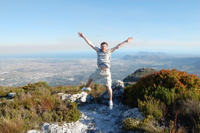
Superman Shaun flying over Cape Town
Off to save the day! I would save so much on cab fare.

I've been putting this post off for nearly a week. I sat down to sort through photos and write it up, but gave up when Photoshop quit, taking three of my panoramas with it. After sulking for a few days, it seems like a nice Saturday afternoon has been the cure for this. Take two...

I mentioned a few days ago that I'd be hiking Lion's Head Mountain. Lion's Head HikeWell, here is the deal: You may remember that Lion's Head is one of the features that can be seen from Table Mountain, as you overlook the city. It is far smaller, and much more isolated, coming to more of a peak than a plateau. It is a very popular Cape Town pastime to hike to top for sunset, but especially around full moon, because of this...

On the night of a full moon, a look to the west from atop Lion's Head will have a beautiful sunset over the ocean. And at the same time, a look to the east will have a full moon rising above the city of Cape Town, among all of the blues and purples on the opposite horizon of a sunset. And since this is the cape, a look to the other directions offers mountains, Robben Island, the shipyard, and more ocean. I had to see for myself.

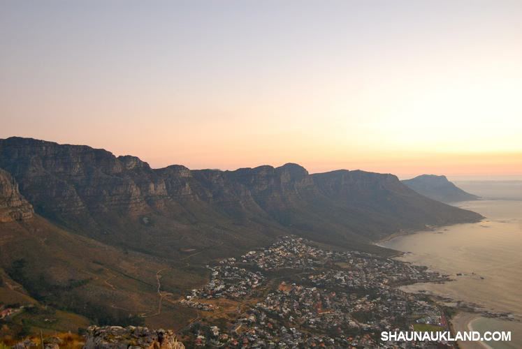
After an hour ascent, the first thing I noticed upon reaching the top was that the excellent view of Table Mountain really shows the distance from the top to the bottom. You'll remember from when I hiked Table Mountain, we got stranded on the top, without a running cable car, around sunset. We then descended down thousands of feet as quick as we could, ending the last half hour of the hike in the dark with cell phone lights. Well, here is where we started and where we ended, for a bit more perspective:

3-table-mountain-hike.jpg
Our frantic starting and ending points.

Back to Lion's Head. Luckily, Kara and I chose to do the hike the night before the "official" full moon, and we couldn't tell a difference. There weren't that many people, only about 50. Most of them were students from a local high school Geography class. I made friends with them. They attempted to repeat where I am from, something like Winsconskin (it was even on my shirt!).

4-school-kids.JPG

My fears about how many people would show up were for naught. Things were way more hectic the next night, though, when my roommates went to find hundreds of others. After a few random photos, I posted up my tripod along with a photographer (trying to act like I was in the big leagues).

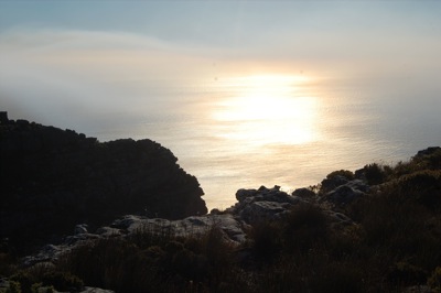
The sun began to set:
5-lions-head-sunset.JPG

Time for the panoramas. In the opposite direction:
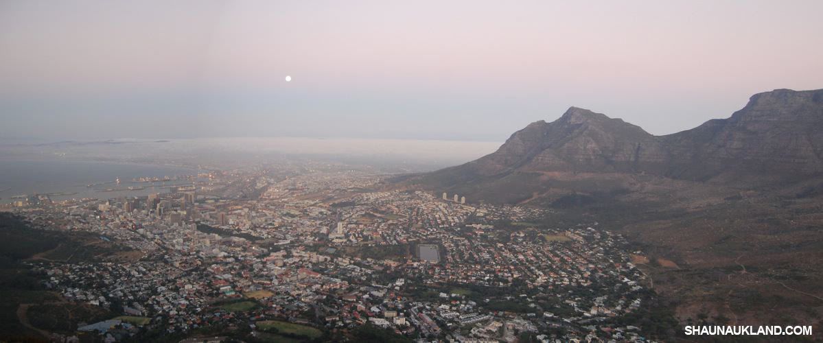
Moon Rising over Cape Town, South Africa
The moon rising over the city.

Table Mountain at dusk from Lion's Head
A look to the north.

And now the money shots:
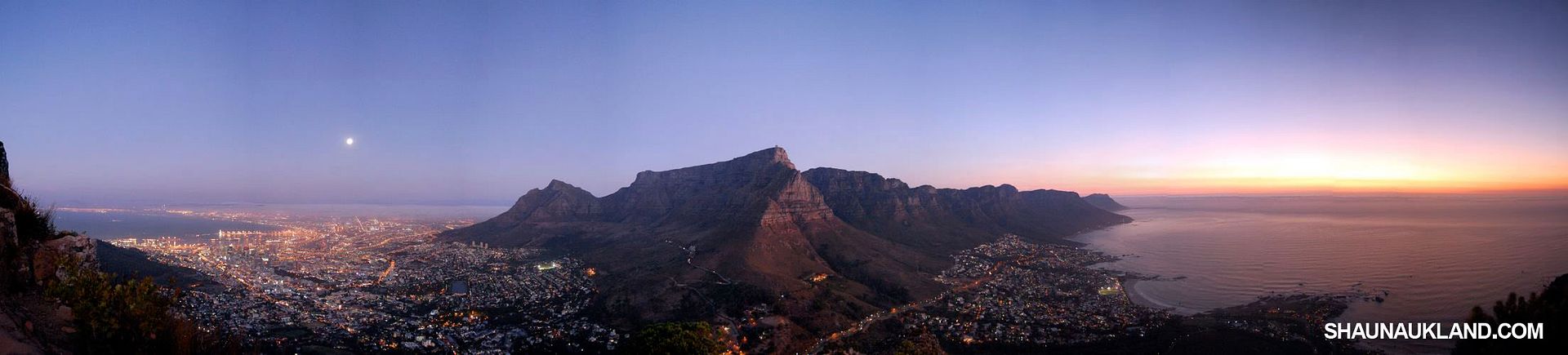
Full moon sunset panorama from Lion's Head over Cape Town
The full view. Nearly 360ยบ.

From full moon to sunset. This is 21 different photos, so they didn't blend perfectly. Still worth it.
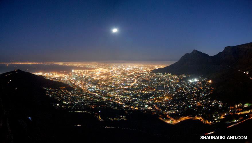
Full moon over Cape Town at night.
And night falls over Cape Town.

The full moon helped offer enough light for most of the hike down, until we got on the dark side (dun dun dunnn!), and the trusty Nokia 1200 came back out. There is also a general caution for crime in the area, since it is nighttime, and there are mostly tourists with cameras and cell phones, etc. But there was a policeman on a four wheeler that came down with us for a bit, so we didn't get stabbed or otherwise maimed. All in all, it was incredible.


Monday, February 16, 2009

Table Mountain!

View from the Beacon

The city of Cape Town is unique for a couple of reasons. It is the oldest "city" in South Africa and maybe the continent, which has lended it the name "the Mother City". So, it has a very rich historical history of trading, colonization, and immigration. But geographically, the huge metropolis sits at the bottom of the continent, impressively nestled between a large plateau and two oceans. That plateau, of course, is Table Mountain, and it rises 3,500 feet above sea level. Well, I hiked it yesterday!

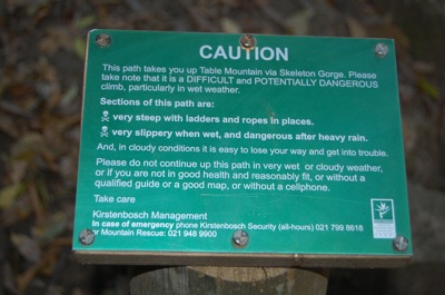
We started around 2:30pm. We took a cab to Kirstenbosch National Botanical Garden. I got some nice photos of flowers, mostly for Lyndsey. Ling Ling... I got some proteas for you, as well as dead birds of paradise :-). We decided to take the route named Skeleton Gorge, which sounded ominous, challenging, and no doubt breathtaking at the same time.

table1.JPG

table1a.JPG

The scenery on the way up felt a lot like the hikes that I did in Rocky Mountain National Park in Colorado. Well kept, challenging, and long, but with less snow. Until we got to the ladders, that was new. They were actually very sturdy, and very fun. The hikers were three of my roommates (Maria, Justin, and Kara), and Stefen from Germany. As we got higher, we began seeing glimpses of the city through the trees. Once we got past most of the trees, we found a very nice view of the area.

table2.JPG

table3.JPG

The above photo of me was taken about 2.5 hours into the hike. And by the way, all photos that have me in them should be credited to Kara. It is difficult to get photos of me when I'm taking so many throughout the day. Onward! We were headed toward Maclear's Beacon, the highest point of the whole mountain. Once beyond the tree line, we wound around the side of the mountain, still climbing. This all felt very much like the first Lord of the Rings. I started humming "Fellowship of the Ring", but Kara didn't understand. She thought it was Auld Lang Syne... whatever. We reached the top in just under 3 hours (5:30pm). The view was breathtaking (pictured at the top of the post as the panorama. Click it for an enlarged version).

While it was pretty hot and sunny on the bottom, it was about 50 degrees and windy as hell up top. I would estimate the wind at 45-60mph, which is rough, because I have no idea. But it was easy to lose your balance from the wind and also very easy to be knocked off your feet. I rather enjoyed this next photo. Maria was attempting to light her cigarette (nearly impossible, I imagine), while Kara can be seen in the background clinging to a stone structure for dear life.  

table4.JPG

table5.JPG

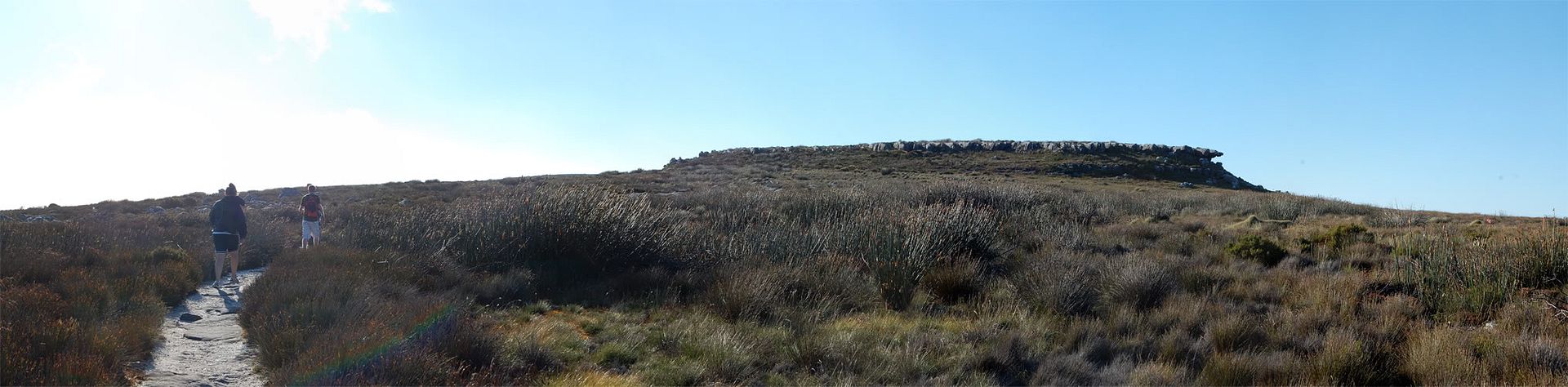
Now, this is where I have to admit I lapsed on what to bring, while insisting that I know better. I only brought a t-shirt. And I've hiked at a lot of places. At Rocky Mountain NP, for example, the temperate can be 85 at the bottom, but 40 degrees up top, with expanses of snow and little wind cover. I've done that, and brought pants, a hat, and a sweatshirt. Well, it slipped my mind, and over the next two hours or so, I got a little chilly. Not so bad, though, because of the sun. It was at this point that we planned to cross the mountain, to reach the upper station for the cable car. This would offer a 5 minute ride down, and hopefully some new pictures. This took about 40 minutes, and was also very cool. For the height and the climate up top, it is so cool to see all the vegetation and some of the wild flowers. Here is a panorama of the top, headed toward the other side.

Crossing Table Mountain

As we reached the other side, the sun was getting lower in the sky and offered some more views. I was getting excited to see a sunset over the city, but wasn't sure if we'd be around long enough because of the wind and temperature. One of the coolest things of being on a mountain at the bottom of a continent is that in almost every direction that you look... there's tons of water. A bay, the ocean, it's just so cool.

table6.JPG

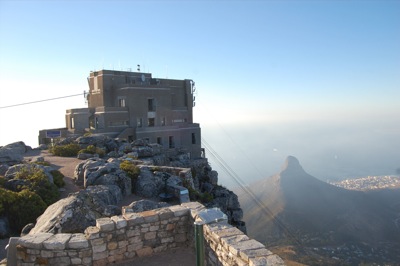
We finally reached the other side, which offered the best view of the city. We were able to get right up to the edge, overlooking everything. The skyline, downtown, suburbs, Table Bay, Robben Island, Lion's Head Mountain, Devil's Peak, the ship yard, the touristy waterfront. It was breathtaking.

table7.JPG

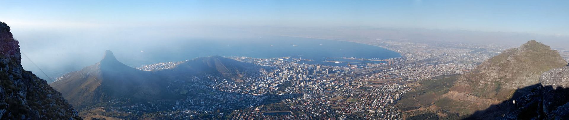
Here is a panorama. From left to right you can see: the cables to the bottom, Lion's Head Mountain (which I like to think of as Pride Rock from the Lion King), Signal Hill, Cape Town and Table Bay, and Devil's Head on the right. It is from my 9 o'clock to my 3 o'clock perspective. Click for the close-up.

View of Cape Town from Table Mountain

Getting cold, it was at this time that we began walking to the cable station, a few minutes away to head down to the bottom. We arrived, and quickly noticed a lack of people. It was CLOSED. Not running on Sunday's maybe? I still don't really know. So we're on top of a mountain, near sunset, and we've only seen at most 5 people since we reached the top (which was a while ago)... and the plan to get down wasn't happening. Awesome.

table8.JPG

So what do you do? You find a trail, and go down... now. We began down Plattekip Gorge, a direct, stone stairway descent to the bottom. With limited sunlight, and exactly 2,509 feet down to go (tired at this point remember, hiking all day and it's 6:50pm)... we hustled. The problem with descending a mountain like that is with the knees. Putting constant resistance of your knees and ankles to go downhill starts to make everything shake after about 45 minutes. After about an hour of descent, the sun began setting. While beautiful, we methodically continued going down at different paces. Looking backward:

table10.JPG

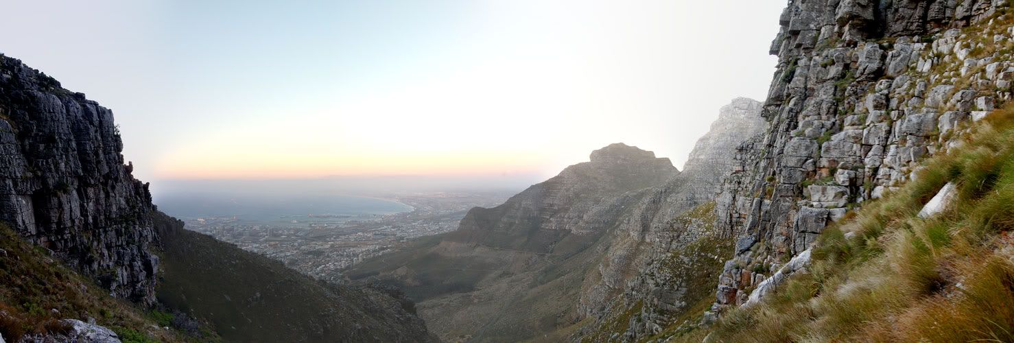
And looking forward, both a single photo and a panorama.

table9.JPG

Descent

It was shortly thereafter that it got dark, and we all pulled out our cellphones for the little light accessory. My little Nokia 1200 may suck in a lot of ways, but my iPhone at home certainly doesn't have a flashlight as effective as this one. We finished the last half hour or so in the dark, and then began walking along a pitch black road toward the lower cable station. I called a cab from my phone to meet us. The view from the trail toward the end...

table11.JPG

If you have never descended a large mountain in the dark, you should try it.... whether by choice or not. It felt very wrong to be walking along the foot of table mountain with merely flashlights and expensive cameras in Cape Town after dark. But we managed, and our cabbie drove us home at literally 60mph through the city streets. I would have objected, but I was far too exhausted and hungry. We got home around 9:30pm, and our planned 2-3 hour hike had come to a close. I've been taking it easy today, since I'm very sore. Below is a collection of photos with captions and better resolution, if you so desire. I managed to whittle my photos from an original 350, to my current 150. Below are just the highlights.